X

register now for
presale tickets

GETTING THERE - TRANSPORTATION

ABOUT THE VENUE

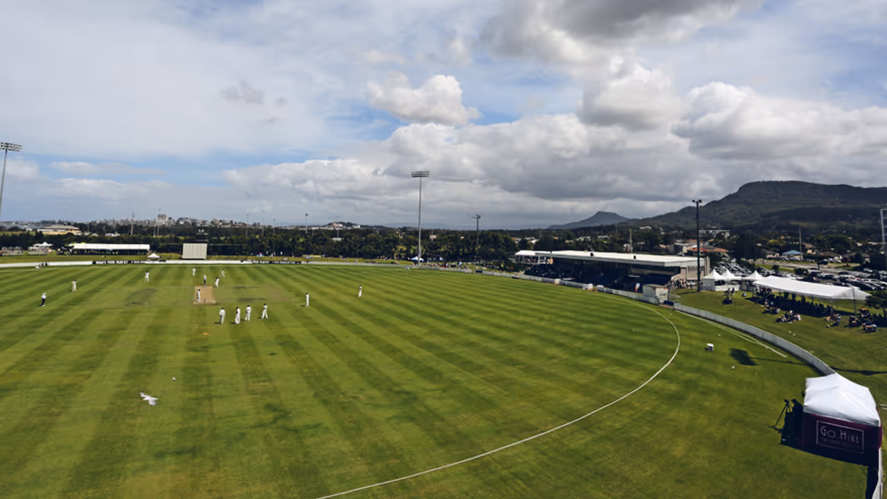
Thomas Dalton Park is a multi-purpose venue primarily serving as the Illawarra's premier facility and is designed to host both local community sports and major regional and even interstate sporting events.

TRAVELLING FROM SYDNEY

By Public Transport (Train & Local Bus/Walk)

Train from Sydney to Fairy Meadow Station

  • From a major Sydney station (e.g., Central Station, Martin Place, Town Hall), take a South Coast Line (SCO) train towards Bomaderry or Port Kembla.
  • Duration: The train journey to Fairy Meadow Station typically takes approximately 1 hour 45 minutes to 2 hours.
  • Frequency: Trains run hourly.
  • Tickets: You will need an Opal card (or a contactless credit/debit card) for your fare. Ensure it's topped up.

From Fairy Meadow Station to Thomas Dalton Reserve

  • Once you arrive at Fairy Meadow Station, Thomas Dalton Reserve is relatively close.
  • Walk: It's about a 10-15 minute walk (approximately 600-800 meters) from Fairy Meadow Station to Thomas Dalton Reserve. You can use a mapping app to guide you.
  • Local Bus: Some local bus routes (e.g., 55A, 55C, 8, 3) pass near Thomas Dalton Park. The closest bus stops are Elliotts Rd before Carters Lane (about a 5-minute walk) or Squires Way before Elliotts Rd (about a 6-minute walk).
  • Check the Transport for NSW Trip Planner for the most current bus schedules and routes from Fairy Meadow Station to the reserve.

By Car (Driving)

  • Route: From Sydney, you will generally take the M1 Princes Motorway south towards Wollongong.
  • Duration: The drive is approximately 80-90 km and typically takes about 1 hour 10 minutes to 1 hour 30 minutes, depending on traffic conditions (which can be heavy, especially during peak hours or on weekends).
  • Directions: Use a GPS or mapping app (like Google Maps or Waze) and enter the address: Thomas Dalton Reserve, Elliots Road, Fairy Meadow, NSW.

TRAVELLING FROM SOUTHERN REGIONAL NSW

By Public Transport (Train & Local Bus/Walk)

Train to Fairy Meadow Station (or Wollongong Station)

  • From towns on the South Coast Line (e.g., Bomaderry/Nowra, Berry, Gerringong, Kiama, Shellharbour, Dapto): Take a South Coast Line (SCO) train heading north towards Sydney. Your destination station for the closest access to Thomas Dalton Reserve is Fairy Meadow Station.
  • Duration: Travel time will depend on your starting station (e.g., Kiama to Fairy Meadow is about 45-60 minutes).
  • Frequency: Services typically run hourly.
  • From towns not on the South Coast Line (e.g., further south or inland): You may need to take a regional coach service (NSW TrainLink coach) to a major hub like Wollongong Station or even Sydney Central Station, and then connect to the South Coast Line.
  • Use the Transport for NSW Trip Planner (transportnsw.info) for specific connections from your starting point.

From Fairy Meadow Station to Thomas Dalton Reserve

  • Walk: From Fairy Meadow Station, Thomas Dalton Reserve is approximately a 10-15 minute walk (around 600-800 meters). You can use a mapping app on your phone to guide you.
  • Local Bus: Some local bus routes (e.g., 55A, 55C, 8, 3) pass near Thomas Dalton Park. The closest bus stops are Elliotts Rd before Carters Lane (about a 5-minute walk) or Squires Way before Elliotts Rd (about a 6-minute walk).
  • Check the Transport for NSW Trip Planner for the most current bus schedules from Fairy Meadow Station to the reserve.

By Car (Driving)

  • Driving is often the most straightforward way to reach Thomas Dalton Reserve from southern NSW, as it provides direct access.
  • Main Route: Your primary route will be the Princes Highway (A1), heading north towards Wollongong.
  • From the Far South Coast (e.g., Batemans Bay, Eden): You will follow the Princes Highway (A1) all the way north.
  • From the Shoalhaven Region (e.g., Nowra, Berry, Kiama): You will continue on the Princes Highway (A1) north through towns like Gerringong, Kiama, Shellharbour, and Dapto, eventually reaching the northern suburbs of Wollongong.
  • From the Southern Highlands (e.g., Bowral, Moss Vale): You would typically take roads like the Illawarra Highway (B89) or local routes to connect to the Princes Highway (A1) on the coast, and then head north towards Wollongong.
  • Final Approach to Thomas Dalton Reserve: As you approach Wollongong, follow signs for Fairy Meadow. Elliots Road is a key road in Fairy Meadow.
  • Duration: Travel time will vary greatly depending on your starting point.
  • From Nowra: Approximately 1 hour 15 minutes to 1 hour 45 minutes.
  • From Batemans Bay: Approximately 3.5 to 4.5 hours.
  • GPS Address: Input Thomas Dalton Reserve, Elliots Road, Fairy Meadow, NSW into your GPS.

TRAVELLING FROM NORTHERN REGIONAL NSW

By Public Transport (Train & Local Bus/Walk)

This option involves taking regional train or coach services to Sydney, then connecting to the South Coast Line, and finally a local connection to the reserve. This can be a long journey depending on your starting point.

Travel from Northern NSW to Sydney (Central Station)

  • From most major towns in northern NSW, you would take an NSW TrainLink North Coast Line train or an NSW TrainLink coach service to Sydney Central Station.
  • Duration: This leg of the journey can range from a few hours (e.g., from Newcastle) to over 10 hours (from far north NSW).
  • Tickets: Book your NSW TrainLink tickets in advance through their website or at a station.

Train from Sydney Central Station to Fairy Meadow Station

  • From Sydney Central Station, take a South Coast Line (SCO) train towards Bomaderry or Port Kembla.
  • Duration: The train journey from Central Station to Fairy Meadow Station typically takes approximately 1 hour 45 minutes to 2 hours.
  • Frequency: Trains run hourly.
  • Tickets: You will need an Opal card (or a contactless credit/debit card) for this fare. Ensure it's topped up.

From Fairy Meadow Station to Thomas Dalton Reserve

  • Walk: From Fairy Meadow Station, Thomas Dalton Reserve is approximately a 10-15 minute walk (around 600-800 meters). You can use a mapping app on your phone to guide you.
  • Local Bus: Some local bus routes (e.g., 55A, 55C, 8, 3) pass near Thomas Dalton Park. The closest bus stops are Elliotts Rd before Carters Lane (about a 5-minute walk) or Squires Way before Elliotts Rd (about a 6-minute walk).
  • Check the Transport for NSW Trip Planner for the most current bus schedules from Fairy Meadow Station to the reserve.

By Car (Driving)

  • Driving is often the most convenient option, offering direct access to the reserve.
  • Main Route: Your primary route will be the Pacific Highway (M1/A1) heading south towards Sydney, and then continuing south towards Wollongong.
  • From the North Coast (e.g., Newcastle, Port Macquarie, Coffs Harbour): You will follow the Pacific Highway (M1/A1) south. As you approach Sydney, you'll continue on the M1 Princes Motorway towards Wollongong.
  • From Inland Northern NSW (e.g., Tamworth, Armidale): You would typically take major highways (e.g., New England Highway, Golden Highway) to connect to the Pacific Highway (M1/A1) or the Hume Motorway (M31) towards Sydney, and then proceed south towards Wollongong.
  • Final Approach to Thomas Dalton Reserve: As you pass through Sydney and head towards Wollongong, follow signs for the M1 Princes Motorway. Once you are in the Wollongong area, take the appropriate exit for Fairy Meadow and follow local signs to Elliots Road.
  • Duration: Travel time will vary significantly based on your starting point. For example:
  • From Newcastle: Approximately 3-4 hours.
  • From Port Macquarie: Approximately 6-7 hours.
  • GPS Address: Input Thomas Dalton Reserve, Elliots Road, Fairy Meadow, NSW into your GPS.

follow us